Boston Common Audio Guide

America's oldest public park, held in common since 1634

Boston Common
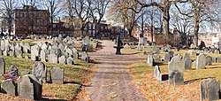
Photo by King of Hearts / Wikimedia Commons / CC BY-SA 4.0 · Wikimedia Commons · CC BY-SA 4.0

6 min of listening · Section 1 of 5: Welcome to Boston Common

Prefer reading? The full guide is below

Here in person? Walk on with Mappu

This audio guide tells one place’s story. Walk Mode keeps going as you walk:

  • It knows where you are and talks about what’s in front of you, not only these chapters.
  • It takes you on to the next sight and follows what interests you.
  • Ask about anything you see, and it answers on the spot.
  • Your phone stays in your pocket.

A 2-hour live walk with Mappu, €4.99.

50 credits from the Starter pack. One-time purchase, no subscription.

Self-guided audio walk. No guide accompanies you. Not affiliated with the sites.

Keep exploring

Discover more places in Mappu.

Boston Common • Section 1 of 5

Boston Common: is there a free audio guide?

Quick answer. Yes. Mappu’s Boston Common audio guide (Boston, United States) is free in your browser: 5 sections and about 6 minutes of listening, in 6 languages. It covers “Before 1634: Shells, Stone Tools and a Famous Sale”, “When Cows Ruled the Common” and “A Stage for History”. In the Mappu app, Walk Mode narrates the places around you as you move and answers your follow-up questions.

Boston Common map

Mappu's own map of the place, with the paths and entrances OpenStreetMap shows around it.

Boston Common mapThe place on the map, with the guide's point marked.

Boston Common: what does the audio guide cover?

  1. 01

    Welcome to Boston Common

    This section of the Mappu audio guide to Boston Common highlights Welcome to Boston Common and points out what to notice during your visit.

    Welcome to Boston Common, the green heart of downtown Boston and considered the oldest public park in the United States. Nearly 50 acres of open space have been kept public since 1634, and you are standing on ground that has been argued over, grazed, drilled on, celebrated and protested on for almost four centuries. What makes the Common remarkable is how many lives it has lived. The National Park Service describes it as a place that shaped the history of conservation, landscape architecture, military and political life, and recreation in Massachusetts. Next door, the adjoining Public Garden shares the title of one of the most visited outdoor public spaces in the city. Over the next few stops, we will look at the people who lived here before the colonists, the unusual bargain that created the Common, the cows that once ruled it, and the many roles it has played since. Let's start by going back to before there was a town at all.

  2. 02

    Before 1634: Shells, Stone Tools and a Famous Sale

    This section of the Mappu audio guide to Boston Common highlights Before 1634: Shells, Stone Tools and a Famous Sale and points out what to notice during your visit.

    Long before the word Common meant anything here, this ground was already in use. Boston's city archaeologists have found buried shell middens, thick layers made up of thousands of clam shells, in areas near the Frog Pond and the Parkman Bandstand. These shells were collected from nearby Back Bay and eaten by Native people. Close to those deposits, archaeologists also uncovered Native pottery and stone tools. Think of a shell midden as an ancient kitchen heap that has quietly kept a record of meals for the people who came after. Then comes 1634. Much of the nearly 50 acres that make up the modern Common was purchased by the town from the Reverend William Blackstone. The purchase came with a clear purpose: to preserve the land as an open green space, held in common by the townspeople. The acreage on the western shore of the Shawmut peninsula was set aside for what the record calls the further benefit of the town and its residents. That decision drew the boundaries of the Common we know today. The footprint has changed only marginally since, which is remarkable for a piece of land in the middle of a growing city.

  3. 03

    When Cows Ruled the Common

    This section of the Mappu audio guide to Boston Common highlights When Cows Ruled the Common and points out what to notice during your visit.

    Picture this place without manicured paths: rolling, featureless hills and open field, more pasture than park. For more than a century, the Common served primarily as public grazing space. White male landowners in Boston were entitled to graze their cows or sheep here, and cattle and sheep did indeed roam the Common until the 1830s. It turned out to be too popular. The land became overgrazed so quickly that by 1646 the town had to place restrictions on the animals. The record of May 1646 is wonderfully specific: no dry cattle, young cattle, or horse shall be free to go on the Common that year, but one horse of Elder Oliver. Imagine being the one person in town with an exemption. The cows were finally removed in 1830, and that change marks a turning point. As the open field was transformed into a formal park during the nineteenth century, use of the Common by residents increased. A pasture became a place for people to gather, stroll and spend their leisure time, which is still how most visitors use it today.

  4. 04

    A Stage for History

    This section of the Mappu audio guide to Boston Common highlights A Stage for History and points out what to notice during your visit.

    Here is the part that surprises people: the Common has often played several roles at once. Over its history it has served as pastureland, burying ground, military encampment, theater for political action and public ground, sometimes all in the same era. Over nearly 400 years, it has witnessed grazing livestock, British encampments, abolitionist gatherings, speeches, food riots, concerts, militia mustering, protests, ice skating, ball games and public executions. That list reads like a summary of Boston's character, from the military and political dramas of the colonial period through the reform movements that followed, to everyday recreation. Throughout the Common and the Public Garden, markers identify sites of historical significance, so keep an eye out for them as you wander. The Common is also where Boston's best known walking route begins. The Freedom Trail starts here, winds through the historic North End and ends at the Bunker Hill Monument in Charlestown. It is a stroll of two and a half miles over easy terrain that links 16 significant historical sites, including museums, meeting houses and a ship. The Common itself was added to the National Register of Historic Places on July 12, 1972, and designated a National Historic Landmark district on February 27, 1987.

  5. 05

    Before You Head Off

    This section of the Mappu audio guide to Boston Common highlights Before You Head Off and points out what to notice during your visit.

    As you wander on, try reading the Common as layers. Beneath your feet are shell middens left by Native people. Above them is a pasture where townspeople once turned out their animals. On top of that is a formal park that gathers crowds for concerts, skating, games and protests. Look for the historical markers scattered through the Common and the neighboring Public Garden, and notice how little the overall outline has changed since 1634, even as the city grew dense all around it. The Common was bought to be held in common, and you are part of the long line of people who have made use of that idea. If you feel like following the story further, the Freedom Trail begins right here, and the Public Garden is just next door, ready for you to explore.

About this guide

AI-generated from 6 sources; reviewed for accuracy and last updated on October 26, 2026. Verify tickets and opening hours on the official site.

Run a travel site or blog? Embed this audio guide for free.

Walk on from here

This place is stop 1 of 16 of a self-guided walk: Freedom Trail, Boston. About 5.8 km and 75 minutes on foot, plus about 100 minutes of listening.

Route map: walking on from Boston Common16 numbered stops in walking order. Stop 1: Boston Common; Stop 2: Massachusetts State House; Stop 3: Park Street Church; Stop 4: Granary Burying Ground; Stop 5: King's Chapel; Stop 6: Boston Latin School Site; Stop 7: Old Corner Bookstore; Stop 8: Old South Meeting House; Stop 9: Old State House; Stop 10: Boston Massacre Site; Stop 11: Freedom Trail Boston; Stop 12: Paul Revere House; Stop 13: Old North Church; Stop 14: Copp's Hill Burying Ground; Stop 15: USS Constitution; Stop 16: Bunker Hill Monument.Stop 1: Boston Common1Stop 2: Massachusetts State House2Stop 3: Park Street Church3Stop 4: Granary Burying Ground4Stop 5: King's Chapel5Stop 6: Boston Latin School Site6Stop 7: Old Corner Bookstore7Stop 8: Old South Meeting House8Stop 9: Old State House9Stop 10: Boston Massacre Site10Stop 11: Freedom Trail Boston11Stop 12: Paul Revere House12Stop 13: Old North Church13Stop 14: Copp's Hill Burying Ground14Stop 15: USS Constitution15Stop 16: Bunker Hill Monument16
Distances are estimates along the walking route, from OpenStreetMap.

Indicative route. While you walk, watch where you're going, mind the traffic and follow local signs and rules. The map is an aid, not a safety guide. Terms

  1. Boston CommonThis guide

    about 0.4 km · about 5 min on foot

  2. Massachusetts State House

    about 0.3 km · about 3 min on foot

  3. Park Street Church

    about 0.1 km · about 1 min on foot

  4. Granary Burying Ground

    about 0.2 km · about 2 min on foot

  5. King's Chapel

    about 0.1 km · about 1 min on foot

  6. Boston Latin School Site

    about 0.1 km · about 1 min on foot

  7. Old Corner Bookstore

    about 0.1 km · about 1 min on foot

  8. Old South Meeting House

    about 0.2 km · about 3 min on foot

  9. Old State House

    about 0.1 km · about 1 min on foot

  10. Boston Massacre Site

    about 0.2 km · about 2 min on foot

  11. Freedom Trail Boston

    about 0.8 km · about 11 min on foot

  12. Paul Revere House

    about 0.4 km · about 6 min on foot

  13. Old North Church

    about 0.2 km · about 2 min on foot

  14. Copp's Hill Burying Ground

    about 1.4 km · about 18 min on foot

  15. USS Constitution

    about 1.4 km · about 19 min on foot

  16. Bunker Hill Monument
Photo attribution

Walk Mode, in the free Mappu app: 2 hours for 50 credits (€4.99 Starter pack)

See the whole walk

Planning a trip to Boston?

Get your plan

Mappu sketches your days free in the chat, no account needed. Then take the full plan with you:

  • Weekend trip, €9.99: Your day-by-day plan plus 2 live walks
  • Save your trip’s free guides on your phone in the Mappu app: they play with no signal
See the trip packs

Already going? The 2-hour live walk in Boston is €4.99

Plan your trip on a map and get an audio guide for almost any place nearby: just tap it on the Mappu map.

Common questions

Boston Common: how long is the free audio guide?

About 6 minutes of listening in 5 sections: “Welcome to Boston Common”, “Before 1634: Shells, Stone Tools and a Famous Sale”, “When Cows Ruled the Common”, “A Stage for History”, and “Before You Head Off”.

Boston Common: what can I ask Mappu after the guide?

You can ask follow-up questions such as “What have archaeologists found beneath Boston Common that tells us about the Native people who used this land?” and keep asking in Mappu, with the guide connected to your map and trip plan.