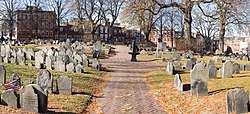
Copp's Hill Burying Ground Audio Guide

Boston's hilltop of memory above the North End and the harbor

Copp's Hill Burying Ground
Photo by Rhododendrites / Wikimedia Commons / CC BY-SA 4.0 · Wikimedia Commons · CC BY-SA 4.0

7 min of listening · Section 1 of 5: Welcome to Copp's Hill Burying Ground

Prefer reading? The full guide is below

Here in person? Walk on with Mappu

This audio guide tells one place’s story. Walk Mode keeps going as you walk:

  • It knows where you are and talks about what’s in front of you, not only these chapters.
  • It takes you on to the next sight and follows what interests you.
  • Ask about anything you see, and it answers on the spot.
  • Your phone stays in your pocket.

A 2-hour live walk with Mappu, €4.99.

50 credits from the Starter pack. One-time purchase, no subscription.

Self-guided audio walk. No guide accompanies you. Not affiliated with the sites.

Keep exploring

Discover more places in Mappu.

Copp's Hill Burying Ground • Section 1 of 5

Copp's Hill Burying Ground: is there a free audio guide?

Quick answer. Yes. Mappu’s Copp's Hill Burying Ground audio guide (Boston, United States) is free in your browser: 5 sections and about 7 minutes of listening, in 6 languages. It covers “From Windmill Hill to the North Burying Ground”, “A Cannon Platform Above the Harbor” and “Mathers, Lanterns and Prince Hall”. In the Mappu app, Walk Mode narrates the places around you as you move and answers your follow-up questions.

Copp's Hill Burying Ground map

Mappu's own map of the place, with the paths and entrances OpenStreetMap shows around it.

Copp's Hill Burying Ground mapThe place on the map, with the guide's point marked.

Copp's Hill Burying Ground: what does the audio guide cover?

  1. 01

    Welcome to Copp's Hill Burying Ground

    This section of the Mappu audio guide to Copp's Hill Burying Ground highlights Welcome to Copp's Hill Burying Ground and points out what to notice during your visit.

    Welcome to Copp's Hill Burying Ground, perched on a rise in the heart of Boston's North End. The hill is bordered by Hull Street, Charter Street and Snow Hill Street, and it is a stop on the Freedom Trail. As you step in, notice how the ground lifts you above the rooftops. That height is a big part of this place's story. This is the second-oldest burying ground in Boston, after the one at King's Chapel, which dates to 1630. The town laid it out in 1659, and for almost two centuries it kept receiving the people of the North End. Over 10,000 people rest here. They include famous theologians, working craftspeople, and early Bostonians of African descent whose graves are mostly unmarked. Over the next few stops we will look at how the hill got its name, how the cannons of 1775 turned it into a military post, and whose stories lie beneath the slate. Take your time. The stones lean, the ground is uneven, and every marker has something to say.

  2. 02

    From Windmill Hill to the North Burying Ground

    This section of the Mappu audio guide to Copp's Hill Burying Ground highlights From Windmill Hill to the North Burying Ground and points out what to notice during your visit.

    Before this was a cemetery, it was a working hill. Its colonial story starts in the 1630s with a windmill for grinding grain, and the rise was once known as Windmill Hill. Later the name Copp's Hill took hold, after William Copp, a shoemaker who lived near today's Prince Street. Another name you may meet is Shoemaker's Hill. The cemetery began on February 20, 1659, when the town bought land on the hill from John Baker and Daniel Turell. Old records often call it simply the North Ground, or the North Burying Ground. Later, a small parcel was bought from John Bishop of Medford. It was used as a burying place and later merged with the older ground. This patchwork explains why you can't trace the original boundaries today. The burying ground now covers about 2 acres, made up of four parcels acquired one after another. The first burial area was a rough parallelogram about half the width of the present site, running along Charter and Snow Hill streets. Look at the layout and you are reading the town's growth, parcel by parcel.

  3. 03

    A Cannon Platform Above the Harbor

    This section of the Mappu audio guide to Copp's Hill Burying Ground highlights A Cannon Platform Above the Harbor and points out what to notice during your visit.

    Height is valuable in war, and in 1775 this hill had plenty of it. Its position overlooking the harbor and the neighboring towns made it strategically important during the Revolution. On the southwest side, the British set up their North Battery and an earthworks. On June 17, 1775, Generals John Burgoyne and Henry Clinton directed operations from this spot. Naval guns pounded the fortifications the colonists had built the night before on Breed's Hill, across the water in Charlestown. The artillery fire from Copp's Hill helped the British push the colonial forces off that hill, and the shelling ended with the torching of Charlestown. There is a smaller story too. Some historians suggest British soldiers used a few of the headstones here for target practice. Whatever the truth of that, the setting is vivid. Look out toward Charlestown, where the Bunker Hill Monument stands in the distance, and picture smoke over the water. Beyond the hill on that side you can also spot the masts of the ships docked at the old Navy Yard. After the Revolution, the burying ground was neglected through the early decades of the nineteenth century. By the 1830s, city-led beautification projects began to transform its appearance.

  4. 04

    Mathers, Lanterns and Prince Hall

    This section of the Mappu audio guide to Copp's Hill Burying Ground highlights Mathers, Lanterns and Prince Hall and points out what to notice during your visit.

    The people buried here make a remarkable guest list. The Mather tomb holds Increase, Samuel and Cotton Mather, three influential and notorious theologians of Boston, members of a prominent ministerial family. Alongside them lie thousands of artisans, craftspeople and tradesmen. Their markers and epitaphs reflect the trades and businesses of the North End in the seventeenth and eighteenth centuries. Two names connect to the night of April 18, 1775. Merchant John Pulling Junior and Robert Newman, the sexton, or caretaker, of Old North Church, are the two men believed to have held the signal lanterns warning of the British advance toward Lexington and Concord. Both are buried on this hill. Then there is Prince Hall. With his fellow masons, he led his community as an activist for the abolition of enslavement and for recognition of Black residents as equal citizens in Massachusetts. His original headstone is modest. Beside it stands a monument erected by his modern Masonic brothers. The hill is also the resting place of many early Bostonians of African descent. On the Snow Hill Street side are many unmarked graves of African Americans who lived in the community called New Guinea, at the foot of the hill.

  5. 05

    Before You Head Off

    This section of the Mappu audio guide to Copp's Hill Burying Ground highlights Before You Head Off and points out what to notice during your visit.

    As you wander out, step across Hull Street and look for a remarkably thin four-story house built shortly after the Civil War. It is only 10.4 feet wide at its widest point, and the Boston Globe has called it the narrowest house in Boston. It makes a charming postscript to a hill full of stories. Before you go, try a few experiments. Read the epitaphs and see which trades you can spot. Walk to the edge of the hill and take in the harbor view that made the place so valuable in 1775. Then think about the Snow Hill Street side, where many graves have no stone at all, and about how a name carved in slate is only part of who lies here. The North End has more to show you beyond these walls, including the Old North Church, whose steeple is tied to the lantern story you've just heard. Which of the hill's many stories will you follow next?

About this guide

AI-generated from 6 sources; reviewed for accuracy and last updated on October 26, 2026. Verify tickets and opening hours on the official site.

Run a travel site or blog? Embed this audio guide for free.

Walk on from here

This place is stop 14 of 16 of a self-guided walk: Freedom Trail, Boston. About 5.8 km and 75 minutes on foot, plus about 100 minutes of listening.

Route map: walking on from Copp's Hill Burying Ground16 numbered stops in walking order. Stop 1: Boston Common; Stop 2: Massachusetts State House; Stop 3: Park Street Church; Stop 4: Granary Burying Ground; Stop 5: King's Chapel; Stop 6: Boston Latin School Site; Stop 7: Old Corner Bookstore; Stop 8: Old South Meeting House; Stop 9: Old State House; Stop 10: Boston Massacre Site; Stop 11: Freedom Trail Boston; Stop 12: Paul Revere House; Stop 13: Old North Church; Stop 14: Copp's Hill Burying Ground; Stop 15: USS Constitution; Stop 16: Bunker Hill Monument.Stop 1: Boston Common1Stop 2: Massachusetts State House2Stop 3: Park Street Church3Stop 4: Granary Burying Ground4Stop 5: King's Chapel5Stop 6: Boston Latin School Site6Stop 7: Old Corner Bookstore7Stop 8: Old South Meeting House8Stop 9: Old State House9Stop 10: Boston Massacre Site10Stop 11: Freedom Trail Boston11Stop 12: Paul Revere House12Stop 13: Old North Church13Stop 14: Copp's Hill Burying Ground14Stop 15: USS Constitution15Stop 16: Bunker Hill Monument16
Distances are estimates along the walking route, from OpenStreetMap.

Indicative route. While you walk, watch where you're going, mind the traffic and follow local signs and rules. The map is an aid, not a safety guide. Terms

  1. Boston Common

    about 0.4 km · about 5 min on foot

  2. Massachusetts State House

    about 0.3 km · about 3 min on foot

  3. Park Street Church

    about 0.1 km · about 1 min on foot

  4. Granary Burying Ground

    about 0.2 km · about 2 min on foot

  5. King's Chapel

    about 0.1 km · about 1 min on foot

  6. Boston Latin School Site

    about 0.1 km · about 1 min on foot

  7. Old Corner Bookstore

    about 0.1 km · about 1 min on foot

  8. Old South Meeting House

    about 0.2 km · about 3 min on foot

  9. Old State House

    about 0.1 km · about 1 min on foot

  10. Boston Massacre Site

    about 0.2 km · about 2 min on foot

  11. Freedom Trail Boston

    about 0.8 km · about 11 min on foot

  12. Paul Revere House

    about 0.4 km · about 6 min on foot

  13. Old North Church

    about 0.2 km · about 2 min on foot

  14. Copp's Hill Burying GroundThis guide

    about 1.4 km · about 18 min on foot

  15. USS Constitution

    about 1.4 km · about 19 min on foot

  16. Bunker Hill Monument
Photo attribution

Walk Mode, in the free Mappu app: 2 hours for 50 credits (€4.99 Starter pack)

See the whole walk

Planning a trip to Boston?

Get your plan

Mappu sketches your days free in the chat, no account needed. Then take the full plan with you:

  • Weekend trip, €9.99: Your day-by-day plan plus 2 live walks
  • Save your trip’s free guides on your phone in the Mappu app: they play with no signal
See the trip packs

Already going? The 2-hour live walk in Boston is €4.99

Plan your trip on a map and get an audio guide for almost any place nearby: just tap it on the Mappu map.

Common questions

Copp's Hill Burying Ground: how long is the free audio guide?

About 7 minutes of listening in 5 sections: “Welcome to Copp's Hill Burying Ground”, “From Windmill Hill to the North Burying Ground”, “A Cannon Platform Above the Harbor”, “Mathers, Lanterns and Prince Hall”, and “Before You Head Off”.

Copp's Hill Burying Ground: what can I ask Mappu after the guide?

You can ask follow-up questions such as “How did a windmill hill and a shoemaker's name become the Copp's Hill we know today?” and keep asking in Mappu, with the guide connected to your map and trip plan.