Mount Wakakusa Audio Guide

A grassy hill above Nara Park, with grazing deer and wide city views

Mount Wakakusa
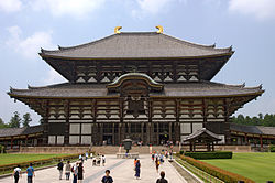
Photo by The original uploader was OhMyDeer at English Wikipedia.Wikimedia CommonsCC BY-SA 2.1 jp

5 min of listening · Section 1 of 5: Welcome to Mt. Wakakusa

Prefer reading? The full guide is below

Here in person? Walk on with Mappu

This audio guide tells one place’s story. Walk Mode keeps going as you walk:

  • It knows where you are and talks about what’s in front of you, not only these chapters.
  • It takes you on to the next sight and follows what interests you.
  • Ask about anything you see, and it answers on the spot.
  • Your phone stays in your pocket.

A 2-hour live walk with Mappu, €4.99.

50 credits from the Starter pack. One-time purchase, no subscription.

Self-guided audio walk. No guide accompanies you. Not affiliated with the sites.

Keep exploring

Discover more places in Mappu.

Mount Wakakusa • Section 1 of 5

Mount Wakakusa: is there a free audio guide?

Quick answer. Yes. Mappu’s Mount Wakakusa audio guide (Nara, Japan) is free in your browser: 5 sections and about 5 minutes of listening, in 8 languages. It covers “The Climb and the Panorama at Mt. Wakakusa”, “The Hillside That Lights Up Over Nara” and “Mt. Wakakusa and the First Capital”. In the Mappu app, Walk Mode narrates the places around you as you move and answers your follow-up questions.

Mount Wakakusa map

Mappu's own map of the place, with the paths and entrances OpenStreetMap shows around it.

Mount Wakakusa mapThe place on the map, with the guide's point marked.

Mount Wakakusa: what does the audio guide cover?

  1. 01

    Welcome to Mt. Wakakusa

    Welcome to Mt. Wakakusa, a hill in the city of Nara that is easy to recognize. Its Japanese name is 若草山, Wakakusa-yama, and it means "young grass." It rises to 342 meters, or 1,122 feet, just east of Nara Park. Its smooth, grassy slopes stand out clearly against the wooded hills around it. The hill is also known as Mount Mikasa. This guide tells the story of the hill and its setting beside Nara's famous temples. In the next few minutes we will look at the gentle climb and the view from the top. We will also look at the yearly fire that lights the hillside, and at the ancient capital that spreads out beneath it. Think of Mt. Wakakusa as a natural balcony over one of Japan's oldest cities. From here you can see how much history sits in a small area, from temple roofs to open grassland.

  2. 02

    The Climb and the Panorama at Mt. Wakakusa

    The climb up Mt. Wakakusa is gentle and open. You walk over grassland where deer graze freely, with no thick forest closing in around you. The walk to the summit takes about 30 to 40 minutes, which makes it one of the easiest ways to get a big view in the Nara area. The reward is a wide panorama. From the top you can look out over Todaiji, and you can pick out the pagoda of Kofukuji. Beyond them lies the whole city of Nara, and the mountains stretch away behind it. The view is especially magical at sunset, when the city and the hills take on softer light. It helps to remember how the hill sits in the landscape. It rises directly behind the temples of Nara Park, and its bare turf is easy to spot from below. That is why the view works in both directions: from the top you see the temples, and from the temples you see the hill.

  3. 03

    The Hillside That Lights Up Over Nara

    Mt. Wakakusa is best known for a spectacle. As part of an annual festival, the hillside is set ablaze, and the burning slope can be seen from the city of Nara and from many other places across the northern part of the Nara Basin. The viewing spots are part of the story. The most popular ones include Nara Park near the five-storied pagoda of Kofukuji, Oike pond near Yakushiji, and the site of Heijo Palace. People also watch from farther away. The blazing hillside is visible from Mount Kongo and Mount Ikoma, from Hozanji, and from the ryokan street directly below it. It can even be seen from the multilevel parking lot at a shopping mall in Yamato-Koriyama, and from buildings in the cities of Kashihara and Gose. So a bare grass hill becomes a landmark for a whole basin. Many people look at the same glowing slope from very different places, and each of them sees the same shape.

  4. 04

    Mt. Wakakusa and the First Capital

    To understand why this hill matters, look at what lies below it. Nara functioned as Japan's capital from 710 to 784. The Historic Monuments of Ancient Nara are recognized as a World Heritage property because they show a critical period in Japan's cultural and political development. They include Buddhist temples, a Shinto shrine with its sacred forest, and an archaeological site. Nara has an exceptional concentration of heritage. Where Kyoto has 23 buildings that are National Treasures dating from before 1573, Nara has 50. The Kasuga shrine, the head shrine of the 3,000 Kasuga shrines across Japan, was built to protect the old capital and promote national prosperity. Together with the Kasuga primeval forest, it is one of the monuments listed in the World Heritage site. The animals are part of the scene too. About 1,300 deer live in Nara Park, and the hill's grassland is part of the same living landscape. From the top of Mt. Wakakusa, you are looking down at the whole setting at once.

  5. 05

    Before You Head Off

    Mt. Wakakusa rewards you with more than one view. Try it once for the open grassland and the deer, and once more for a different mood of light. Sunset over the city and the mountains beyond is said to be especially magical. Once you are up there, try to pick out the landmarks one by one: the roof of Todaiji, the pagoda of Kofukuji, the sweep of the city, and the ridgelines beyond. Then imagine the same slope glowing during the annual festival, seen by crowds from Nara Park and from places much farther away. After you come down, the hill will keep working on you. Look back at it from the temples and its smooth outline will feel familiar. Which side of the story will you take home, the view from the top or the view of the hill?

About this guide

AI-generated from 6 sources; reviewed for accuracy and last updated on October 31, 2026. Verify tickets and opening hours on the official site. Independent guide by Mappu. Not affiliated with or endorsed by the site or its managers.

Run a travel site or blog? Embed this audio guide for free.

Walk on from here

The nearest places with a Mappu audio guide, in walking order: about 2.7 km and 35 minutes on foot in all.

Route map: walking on from Mount Wakakusa4 numbered stops in walking order. Stop 1: Mount Wakakusa; Stop 2: Nara Park; Stop 3: Tōdai-ji; Stop 4: Shōsōin.Stop 1: Mount Wakakusa1Stop 2: Nara Park2Stop 3: Tōdai-ji3Stop 4: Shōsōin4
Distances are estimates: the straight line between places plus 30%.

Indicative route. While you walk, watch where you're going, mind the traffic and follow local signs and rules. The map is an aid, not a safety guide. Terms

  1. Mount WakakusaThis guide

    about 1.5 km · about 21 min on foot

  2. Nara Park

    about 0.7 km · about 9 min on foot

  3. Tōdai-ji

    about 0.4 km · about 6 min on foot

  4. Shōsōin
Photo attribution

Walk Mode, in the free Mappu app: 2 hours for 50 credits (€4.99 Starter pack)

Planning a trip to Nara?

Get your plan

Mappu sketches your days free in the chat, no account needed. Then take the full plan with you:

  • Weekend trip, €9.99: Your day-by-day plan plus 2 live walks
  • Save your trip’s free guides on your phone in the Mappu app: they play with no signal
See the trip packs

Already going? The 2-hour live walk in Nara is €4.99

Plan your trip

Photo attribution

Plan your trip on a map and get an audio guide for almost any place nearby: just tap it on the Mappu map.

Common questions

Mount Wakakusa: how long is the free audio guide?

About 5 minutes of listening in 5 sections: “Welcome to Mt. Wakakusa”, “The Climb and the Panorama at Mt. Wakakusa”, “The Hillside That Lights Up Over Nara”, “Mt. Wakakusa and the First Capital”, and “Before You Head Off”.

Mount Wakakusa: what can I ask Mappu after the guide?

You can ask follow-up questions such as “Which landmarks, such as Todaiji and the Kofukuji pagoda, can I pick out from the top of Mt. Wakakusa?” and keep asking in Mappu, with the guide connected to your map and trip plan.