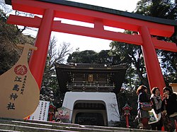
Enoshima Audio Guide

Audio guide for Enoshima

Enoshima
Photo by Σ64Wikimedia CommonsCC BY 4.0

5 min of listening · Section 1 of 5: Welcome to Enoshima

Prefer reading? The full guide is below

Here in person? Walk on with Mappu

This audio guide tells one place’s story. Walk Mode keeps going as you walk:

  • It knows where you are and talks about what’s in front of you, not only these chapters.
  • It takes you on to the next sight and follows what interests you.
  • Ask about anything you see, and it answers on the spot.
  • Your phone stays in your pocket.

A 2-hour live walk with Mappu, €4.99.

50 credits from the Starter pack. One-time purchase, no subscription.

Self-guided audio walk. No guide accompanies you. Not affiliated with the sites.

Keep exploring

Discover more places in Mappu.

Enoshima • Section 1 of 5

Enoshima: is there a free audio guide?

Quick answer. Yes. Mappu’s Enoshima audio guide (Kamakura, Japan) is free in your browser: 5 sections and about 5 minutes of listening, in 8 languages. It covers “An Island at the River's Mouth: Enoshima”, “Pilgrims and Travelers Bound for Enoshima” and “Enoshima in the Modern Era: Rails and Olympic Sails”. In the Mappu app, Walk Mode narrates the places around you as you move and answers your follow-up questions.

Enoshima map

Mappu's own map of the place, with the paths and entrances OpenStreetMap shows around it.

Enoshima mapThe place on the map, with the guide's point marked.

Enoshima: what does the audio guide cover?

  1. 01

    Welcome to Enoshima

    Welcome to Enoshima, known in Japanese as 江の島, a small island sitting just off the coast of Sagami Bay in Kanagawa Prefecture. Before we begin, a quick note on how this guide works. It follows the island's setting and the story of the coast around it, rather than leading you stop by stop through individual buildings and viewpoints. Here is how the map fits together. Enoshima is a small offshore island, about 4 kilometers around, at the mouth of the Katase River. Although you may think of it as a Kamakura neighbor, and it does sit along the same stretch of coast, it is administratively part of the mainland city of Fujisawa. Fujisawa lies on the bay between Chigasaki to the west and Kamakura to the east. Over the next few minutes we will cross the bridge, meet the pilgrims and travelers who made this island famous, and see how it ended up on the world sporting stage. Let us start by looking at the island itself.

  2. 02

    An Island at the River's Mouth: Enoshima

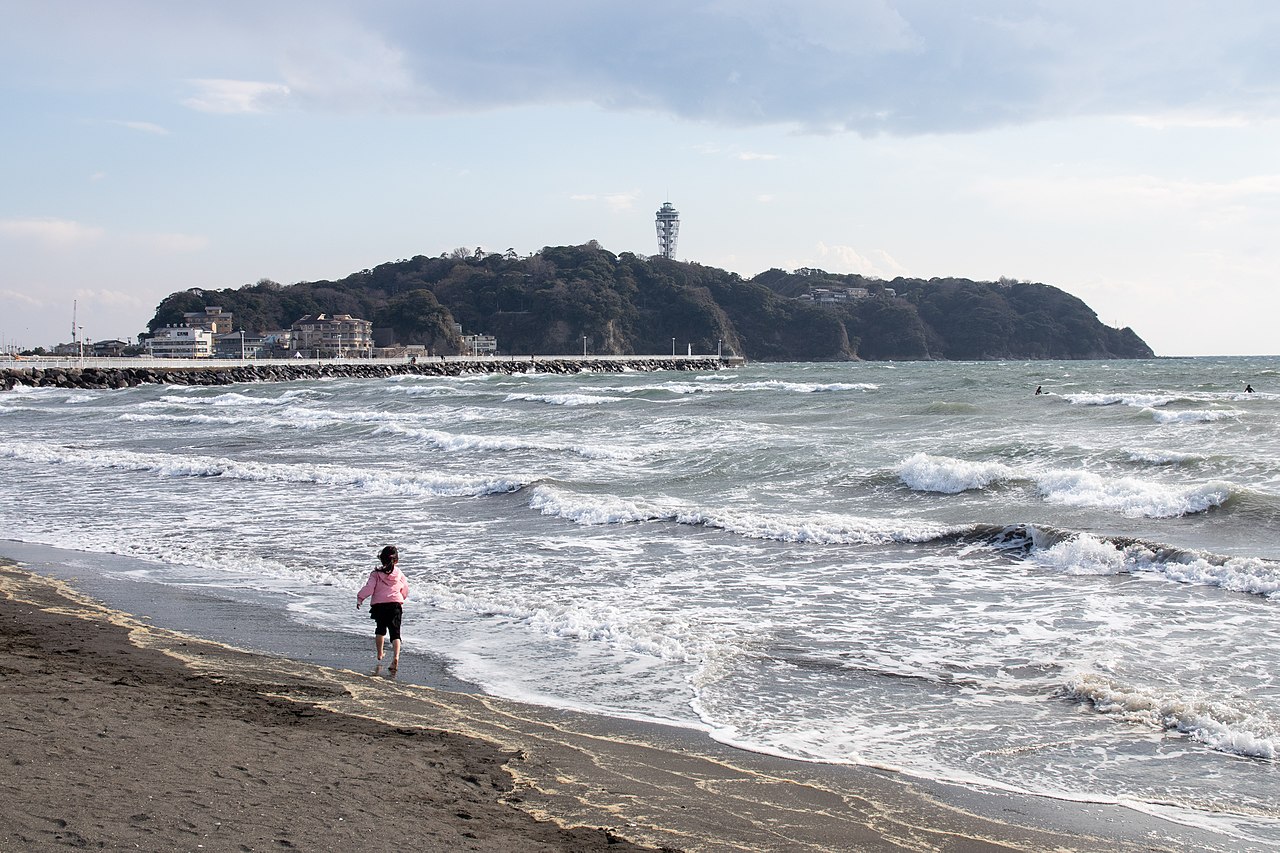
    Picture the geography first, because it explains everything. Enoshima is a small island, about 4 kilometers, or roughly 2.5 miles, in circumference. It sits right where the Katase River empties into Sagami Bay, a part of the great Pacific Ocean. Rivers, sea and a compact island make a landscape that has drawn people for a very long time. Today you do not need a boat to reach it. A bridge 389 meters long, which is about 1,276 feet, links the island to the Katase district of Fujisawa on the mainland. That is a walk of a few minutes over open water, with the island ahead of you and the bay on both sides. That short span matters. It turns a sea-bound island into a place you can step onto almost casually, and it helps explain why Enoshima has long been both a destination and a day out for the people of the surrounding coast.

  3. 03

    Pilgrims and Travelers Bound for Enoshima

    Enoshima's fame is older than the bridge and much older than the railway. The shrines of the island are part of the cultural life of this stretch of coast, and they remain important spiritual centers today. The economy of the early settlements here was built on serving travelers and pilgrims, with fishing along Sagami Bay as the other pillar. Even before the Tokugawa shogunate took power, travelers passing through nearby Fujisawa were often headed for Enoshima, and for Oyama, another mountain destination. Both were popular pilgrimage spots for centuries. Think of Fujisawa as the doorstep and Enoshima as the reward at the end of the walk. During the Edo period, from 1603 to 1867, Fujisawa was a post town on the Tokaido, the main historic land route between Edo, now Tokyo, and Kyoto. That meant a steady stream of people passing within reach of the island, and plenty of reasons to turn off the highway toward the sea.

  4. 04

    Enoshima in the Modern Era: Rails and Olympic Sails

    The modern chapter began with the railway. After the Tokaido Line opened in 1889, Fujisawa grew as a residential suburb of the Tokyo and Yokohama metropolitan area. The coast to the south, with Kugenuma beach and the resorts of Katase and Eno Island, became a seaside escape within reach of the capital. Fujisawa today is about an hour by train from central Tokyo. Then came 1964. When Tokyo hosted the Summer Olympic Games, the yacht harbor on Eno Island was the location for the sailing competitions. Imagine sails racing out from this small island into Sagami Bay, with the world watching a place that pilgrims had been visiting for centuries. The region has paid a price for its coastal setting too. The great Kanto earthquake of 1923 caused heavy damage across Fujisawa, and many houses were destroyed. Yet the area rebuilt, and today it mixes old devotion, seaside leisure and modern city life.

  5. 05

    Before You Head Off

    As you explore, notice how many layers Enoshima holds. There is the geography of river mouth and bay, the old pilgrim traffic that made the island a destination, the shrines that are still spiritual centers, and the harbor that once hosted Olympic sailors. The climate along this coast is humid subtropical, with warm summers and cool winters. September is the wettest month, so it is worth glancing at the sky before you set out. Whatever the weather, look back along the bridge once you are on the island and see how close the mainland feels. From here, the island is yours to wander. See which of those layers you meet first, and which one surprises you.

About this guide

AI-generated from 6 sources; checked automatically and last updated on October 31, 2026. Verify tickets and opening hours on the official site. Independent guide by Mappu. Not affiliated with or endorsed by the site or its managers.

Run a travel site or blog? Embed this audio guide for free.

Walk on from here

The nearest places with a Mappu audio guide, in walking order: about 0.4 km and 5 minutes on foot in all.

Route map: walking on from Enoshima3 numbered stops in walking order. Stop 1: Enoshima; Stop 2: Enoshima Shrine; Stop 3: Enoshima Sea Candle.Stop 1: Enoshima1Stop 2: Enoshima Shrine2Stop 3: Enoshima Sea Candle3
Distances are estimates: the straight line between places plus 30%.

Indicative route. While you walk, watch where you're going, mind the traffic and follow local signs and rules. The map is an aid, not a safety guide. Terms

Walk Mode, in the free Mappu app: 2 hours for 50 credits (€4.99 Starter pack)

Planning a trip to Kamakura?

Get your plan

Mappu sketches your days free in the chat, no account needed. Then take the full plan with you:

  • Weekend trip, €9.99: Your day-by-day plan plus 2 live walks
  • Save your trip’s free guides on your phone in the Mappu app: they play with no signal
See the trip packs

Already going? The 2-hour live walk in Kamakura is €4.99

Useful for your visit

Tickets, tours and practical extras for this trip, from Mappu's partners.

Partner links (Airalo, Amazon, Booking.com, GetYourGuide, Klook, Tiqets, Trip.com, Viator, Welcome Pickups): if you book or buy through them, Mappu may earn a commission, at no extra cost to you.

Plan your trip on a map and get an audio guide for almost any place nearby: just tap it on the Mappu map.

Common questions

Enoshima: how long is the free audio guide?

About 5 minutes of listening in 5 sections: “Welcome to Enoshima”, “An Island at the River's Mouth: Enoshima”, “Pilgrims and Travelers Bound for Enoshima”, “Enoshima in the Modern Era: Rails and Olympic Sails”, and “Before You Head Off”.

Enoshima: what can I ask Mappu after the guide?

You can ask follow-up questions such as “Enoshima belongs to Fujisawa rather than Kamakura. How does that shape the way the surrounding coast is organized?” and keep asking in Mappu, with the guide connected to your map and trip plan.